text and photos: Xavier

 datasheet:
Distance - 13,23km


Distance - 13,23km
Height gain - 1015m
Height lost - 1015m
Altitude Max - 2962m
Altitude min - 1940m
Effective walk: 2h45m
descent: 25min
track: here
video of the day
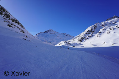
To this sunny Sunday i returned to Col Grand St Bernard region, at the Entremont valley, next to the border with Italy.
I start by heading to the normal route to Col Grand St Bernard, it was windy, at 2250m the route to Grand St Bernard turns West, i continued South and entered the Barasson Combe, at the end of the combe i saw a group of 8/9 ahead of me, they were heading also to Pointe de Barasson, at some point i saw that they were already equipped with "knifes" to the skis, at some points the snow was icy, the idea was to join Arête de Tcholeire and join the summit on foot by the north ridge, but i saw that the group was already struggling to climb, so, at 2700m i approached the West face of Pointe de Barasson, took off my skis and climb directly the West face, a fall in that section means a serious injury, i joined the southwest ridge at about 2850m, no more danger from that point until reaching the summit, colossal views from the Pointe de Barasson(2962m), to the Mont Vélan and to Mont Blanc mountains.
Finally a part of the group left their skis at 2750m and climbed to the summit with crampons, they joined me at the summit a little later, they stayed no more than 10 minutes at the summit, i was alone and they were the only group in the area, the first part of the descent is quite steep and normally is a dangerous section due to wind plaques, so i hurry to go down the north ridge, if i got inside an avalanche they would call rescue, everything went well and once i crossed the delicate section i searched for a place where the snow would be less icy and i found it! I had so much pleasure in this descent, was really cool.
What a fantastic day, what a nice week-end!!
 Bourg St. Bernard


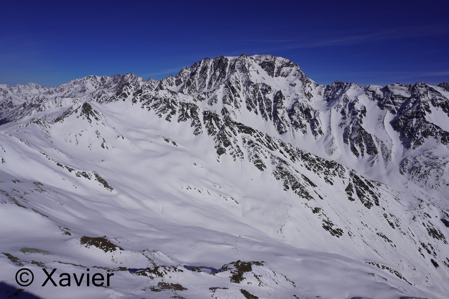
 Mont Mort


 west face of Pointe de Barasson
 southwest ridge


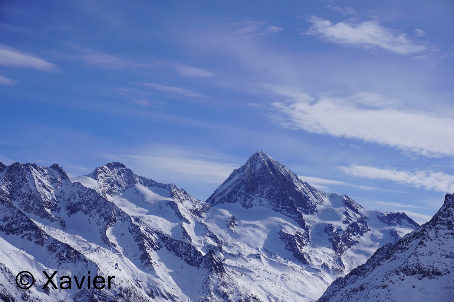
 Mont Vélan

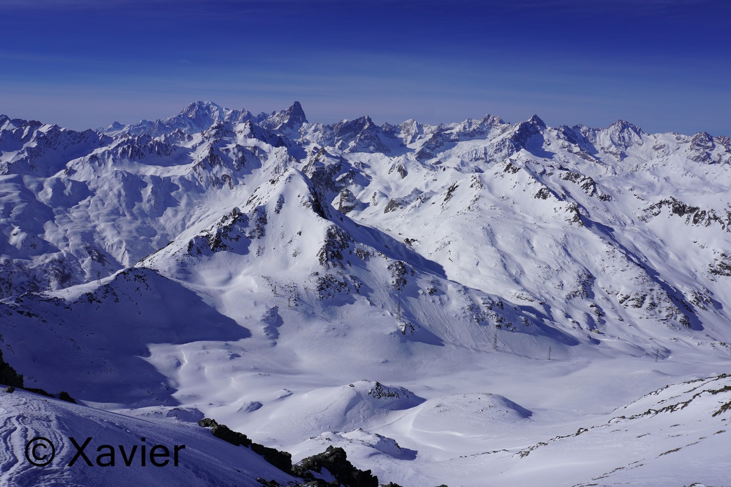
 towards Italy
 Tcholeire ridge on the right


 Mont Blanc and Grandes Jorasses


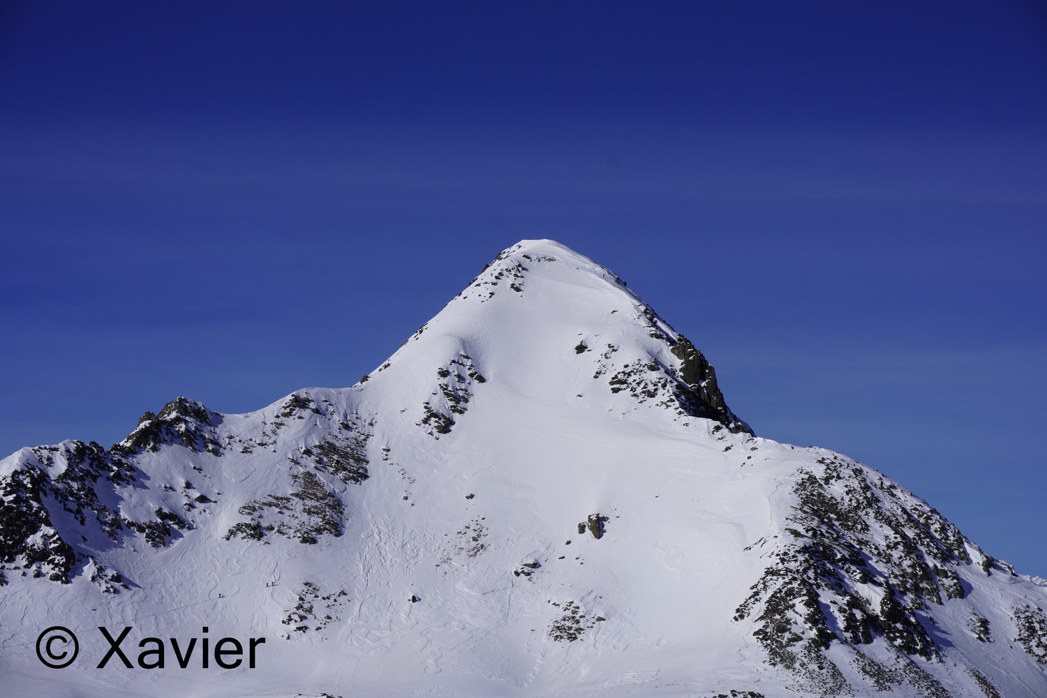
 Pointe de Barasson

descent: 25min
track: here
video of the day
To this sunny Sunday i returned to Col Grand St Bernard region, at the Entremont valley, next to the border with Italy.
I start by heading to the normal route to Col Grand St Bernard, it was windy, at 2250m the route to Grand St Bernard turns West, i continued South and entered the Barasson Combe, at the end of the combe i saw a group of 8/9 ahead of me, they were heading also to Pointe de Barasson, at some point i saw that they were already equipped with "knifes" to the skis, at some points the snow was icy, the idea was to join Arête de Tcholeire and join the summit on foot by the north ridge, but i saw that the group was already struggling to climb, so, at 2700m i approached the West face of Pointe de Barasson, took off my skis and climb directly the West face, a fall in that section means a serious injury, i joined the southwest ridge at about 2850m, no more danger from that point until reaching the summit, colossal views from the Pointe de Barasson(2962m), to the Mont Vélan and to Mont Blanc mountains.
Finally a part of the group left their skis at 2750m and climbed to the summit with crampons, they joined me at the summit a little later, they stayed no more than 10 minutes at the summit, i was alone and they were the only group in the area, the first part of the descent is quite steep and normally is a dangerous section due to wind plaques, so i hurry to go down the north ridge, if i got inside an avalanche they would call rescue, everything went well and once i crossed the delicate section i searched for a place where the snow would be less icy and i found it! I had so much pleasure in this descent, was really cool.
What a fantastic day, what a nice week-end!!