
text and photos: Xavier
Day 1


Day 1


Day 2


datasheet:
Distance - 16km
Height gain - 2250m
Height lost - 2250m
Altitude Max - 4327m
Altitude min - 2280m
Type - linear
Effective walk: 3h + 10h
Degree of difficulty- T4 PD II
track: day1 , day2
video of the day
Outstanding weekend with awesome conditions and with the good company of the Suisse Alpine Club, Monthey section.
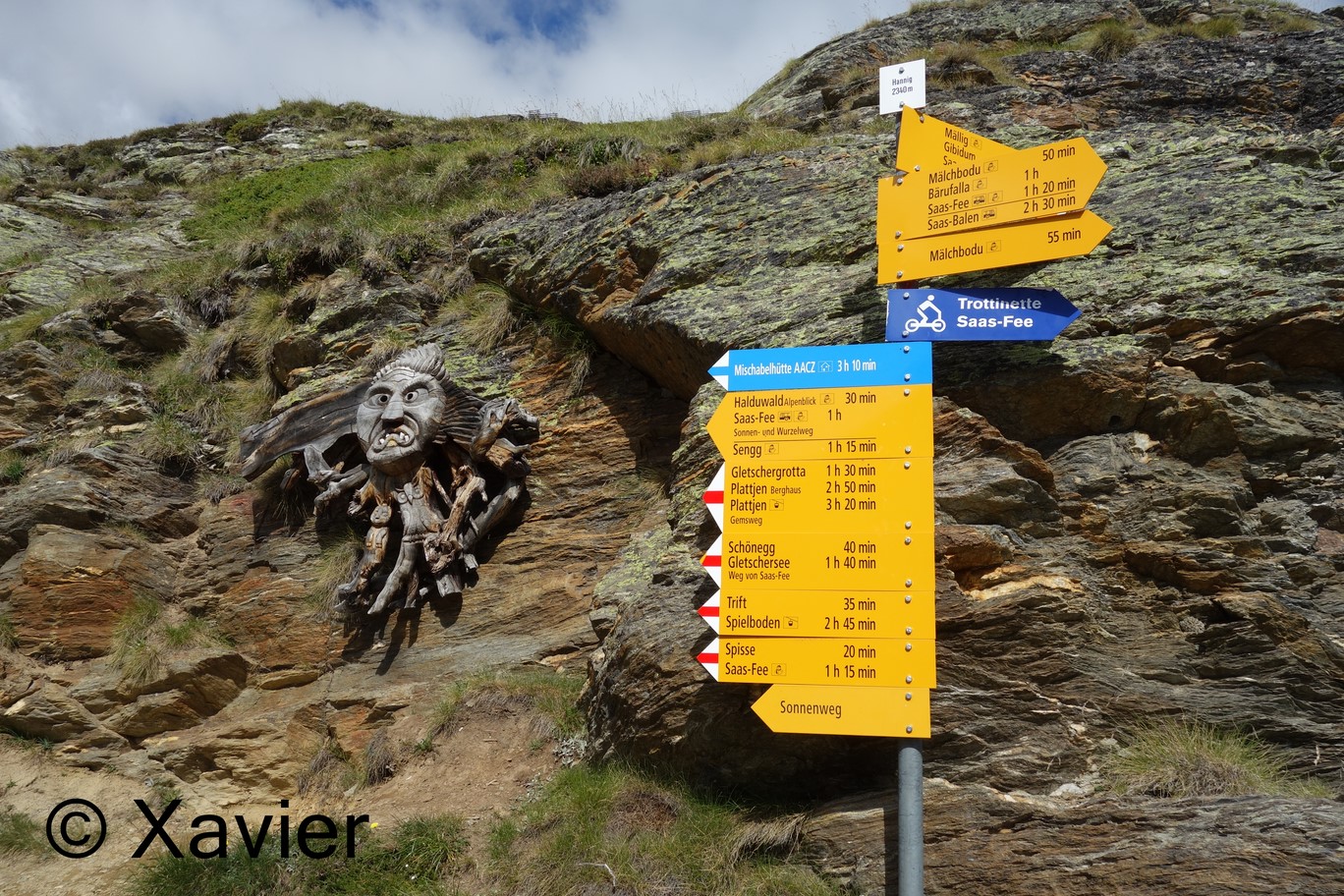
We arrived at Saas-fee about 9 a.m. , had some Coffee and picked up the cable car to Hannig(2339m) in order to gain about 500m.
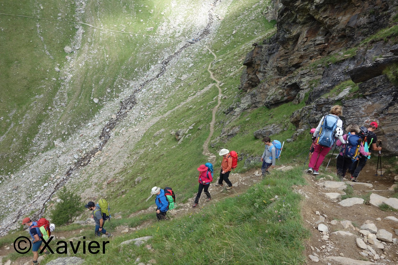
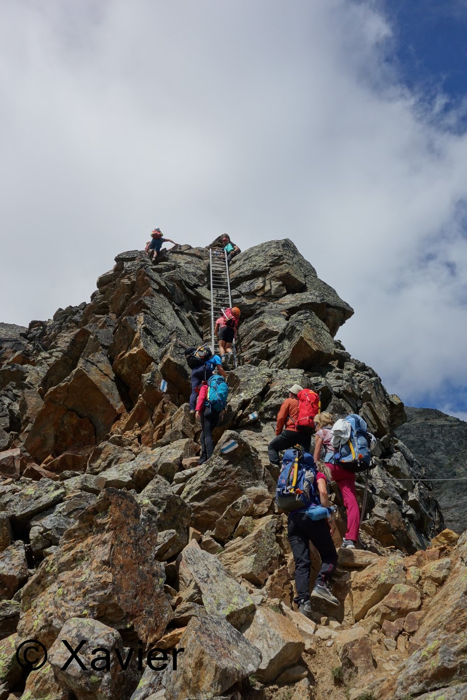
We’re 12, started the hike softly, we had the whole day to reach the Mischabelhutte(3336m), the path climbs gently until it approaches the ridge of the Schwarzhorn, once we reach the ridge at about 2800m the signs blue and white, indicating alpine path, make all the sense, there are a lot of equiped sections with cables, a ladder, the trail goes all along the ridge, but it is never hard.
With about 3h30m of hike we reached the Mischabelhutte, we had lunch and had time to some alpinism formation, wich is always very usefull, specially for me that i’m a rookie.
At 17h30m dinner was served, the refuge was complete, i had a nice moment with some people i didn’t knewn, what a nice group!
At about 9p.m i went inside, for several reasons a part of the group didn’t slept very well, for me it was the night that i slept less in a refuge, but we had a lot of fun!!
We woke up at 3a.m. , had breakfast at 3.15 and started the hike at 4.10a.m.
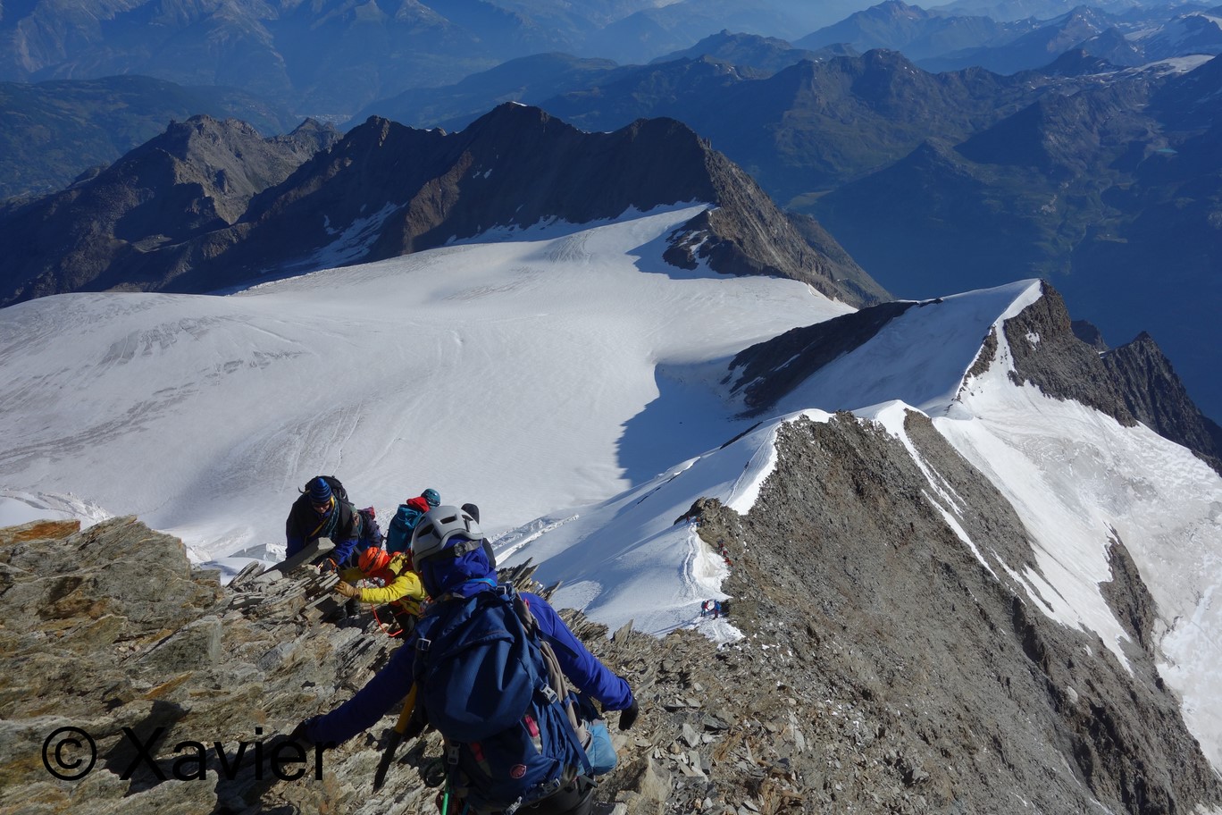
The hike starts by following the ridge to the west, at about 3600m, at the Schwarzhorn(3618m), everyone stops to put the ropes and crampons, that‘ s the part you enter the Hohbalmgletscher, the wind started to blow, not very strong.
Crampons on, the normal way wich we followed, continues to the north heading to Windjoch at 3847m, we arrived there at the sunrise, the wind at this point was much more cold and strong.
Once at the Windjoch the normal way goes to Southwest following always the line of the ridge, there’s only one part that i found a little delicate, it’s not possible to hike normally but with the crampons side by side facing the ridge, not easy to plant the piolet either in this section.
The ridge is all composed by Ice, only the final 50m are rock climbing, not difficult, it is considered a PD(not diificult).
Before the final ascent we waited some 20 Minutes at a place protected from the cold wind, to let the others pass, there was a lot of people on the ridge.
At about 9a.m. we arrived at the summit of the Nadelhorn(4327m), colossal view to Dom and some nice views to Dent Blanche, Zinalrothorn, Weisshorn and Matterhorn.
We started the descent and stopped at the same point protected from the wind to eat something, after a short break we continued down by the same route, once we crossed again the Windjoch to the east, no more wind, and it was very hot.
We crossed the glacier and took out the crampons once we’re out of the glacier, at about 12a.m. reached the Mischabelhutte, time to eat something and return to the cable car Hannig.
At Saas-Fee we recovered the cars and 1h20m later we’re Back to Monthey, were we ended this magnificent weekend.
A special thanks to all members of the alpine club for this memorable weekend at the Valais!
Greetings!!
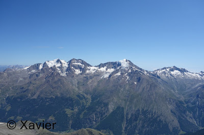
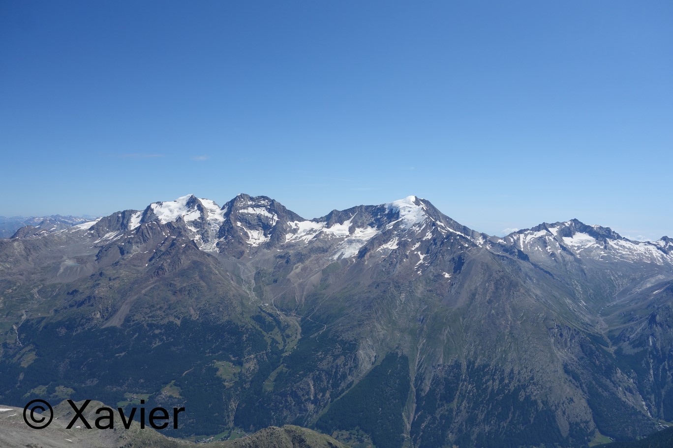
 Fletschhorn, Lagginhorn and Weissmies

 starting point at Hannig
 Allalinhorn


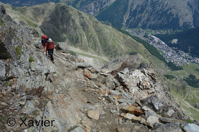
 on the way to Mischabelhutte


 Mischabelhutte


 C'est parti!


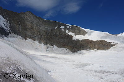
 Hohbalmgletscher


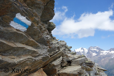
 Windjoch


 Lenspitze


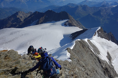
 the ridge that leads to Nadelhorn


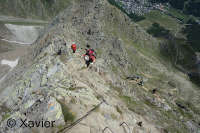
 last part to reach the summit, easy rock climb


 at the summit
 impressive Dom


 Matterhorn and Dent d'Hérens
 Weisshorn and Bishorn


 Bietschhorn at the centre
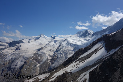
 glacier Aletsch at the centre


 Windjoch on the right and Nadelhorn on the left


 Mischabelhutte


Degree of difficulty- T4 PD II
track: day1 , day2
video of the day
Outstanding weekend with awesome conditions and with the good company of the Suisse Alpine Club, Monthey section.
We arrived at Saas-fee about 9 a.m. , had some Coffee and picked up the cable car to Hannig(2339m) in order to gain about 500m.
We’re 12, started the hike softly, we had the whole day to reach the Mischabelhutte(3336m), the path climbs gently until it approaches the ridge of the Schwarzhorn, once we reach the ridge at about 2800m the signs blue and white, indicating alpine path, make all the sense, there are a lot of equiped sections with cables, a ladder, the trail goes all along the ridge, but it is never hard.
With about 3h30m of hike we reached the Mischabelhutte, we had lunch and had time to some alpinism formation, wich is always very usefull, specially for me that i’m a rookie.
At 17h30m dinner was served, the refuge was complete, i had a nice moment with some people i didn’t knewn, what a nice group!
At about 9p.m i went inside, for several reasons a part of the group didn’t slept very well, for me it was the night that i slept less in a refuge, but we had a lot of fun!!
We woke up at 3a.m. , had breakfast at 3.15 and started the hike at 4.10a.m.
The hike starts by following the ridge to the west, at about 3600m, at the Schwarzhorn(3618m), everyone stops to put the ropes and crampons, that‘ s the part you enter the Hohbalmgletscher, the wind started to blow, not very strong.
Crampons on, the normal way wich we followed, continues to the north heading to Windjoch at 3847m, we arrived there at the sunrise, the wind at this point was much more cold and strong.
Once at the Windjoch the normal way goes to Southwest following always the line of the ridge, there’s only one part that i found a little delicate, it’s not possible to hike normally but with the crampons side by side facing the ridge, not easy to plant the piolet either in this section.
The ridge is all composed by Ice, only the final 50m are rock climbing, not difficult, it is considered a PD(not diificult).
Before the final ascent we waited some 20 Minutes at a place protected from the cold wind, to let the others pass, there was a lot of people on the ridge.
At about 9a.m. we arrived at the summit of the Nadelhorn(4327m), colossal view to Dom and some nice views to Dent Blanche, Zinalrothorn, Weisshorn and Matterhorn.
We started the descent and stopped at the same point protected from the wind to eat something, after a short break we continued down by the same route, once we crossed again the Windjoch to the east, no more wind, and it was very hot.
We crossed the glacier and took out the crampons once we’re out of the glacier, at about 12a.m. reached the Mischabelhutte, time to eat something and return to the cable car Hannig.
At Saas-Fee we recovered the cars and 1h20m later we’re Back to Monthey, were we ended this magnificent weekend.
A special thanks to all members of the alpine club for this memorable weekend at the Valais!
Greetings!!


Sem comentários:
Enviar um comentário