
text and photos: Xavier

 datasheet:
Distance - 17,13km


Distance - 17,13km
Height gain - 1131m
Height lost - 1131m
Altitude Max - 3024m
Altitude min - 1960m
Type - linear
Effective walk: 5h
Degree of difficulty- T3
track: aqui
video do dia
On Saturday after finishing the walk to Becca di Nona we went down to Aosta, had dinner and researched the place to go sleep, we choose the peaceful Colle San Carlo.
On Sunday after breakfast we start the trek to Mont Colmet (3024m), in 40 minutes we pass the beautiful Lago d'Arpy, continue south and the trail bends east to the equally beautiful Lago di Pietra Rossa. With a magnificent view of the Mont Blanc, from there, there is no trail itself but it is well marked with cairns until the peak.
With a 3h30m hike we reached the peak of Mont Colmet (3024m), went down a little north, passed an old construction and there is another peak north of that construction where you have an equally beautiful view of the glacier of the Ruitor and the Mont Blanc massif.
In this second peak there is a panel informing that there is a route that goes along the edge to the fortification zone to the west of Lago d'Arpy, mountaineering trail, it was a pity not to have known this route before, would have climbed there, as it was day to return home we did not risk and went down the "same" way.
We arrived at the car in the middle of the afternoon, a good time to return home.


 Mont Blanc massif

 Lago d'Arpy


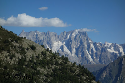


 Mont Blanc


 Lago di Pietra Rossa
 Lago di Petra Rossa


 looking back to the lake


 Mont Colmet


 Mont Colmet


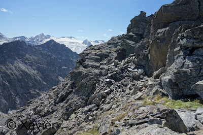
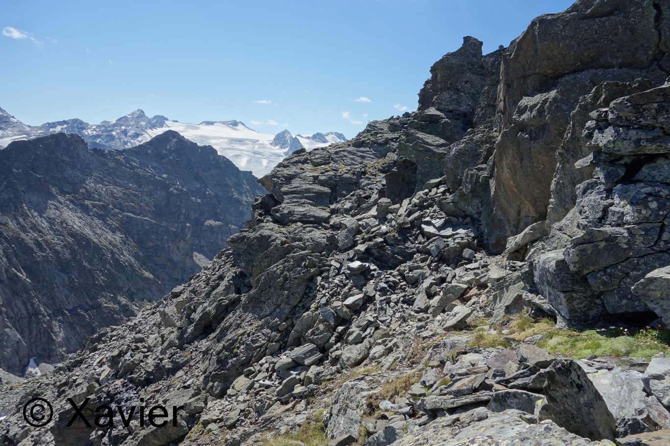
 Ruitor Glacier


 Mont Blanc massif

 Lago di Peitra Rossa


 Lago d'Arpy

Degree of difficulty- T3
track: aqui
video do dia
On Saturday after finishing the walk to Becca di Nona we went down to Aosta, had dinner and researched the place to go sleep, we choose the peaceful Colle San Carlo.
On Sunday after breakfast we start the trek to Mont Colmet (3024m), in 40 minutes we pass the beautiful Lago d'Arpy, continue south and the trail bends east to the equally beautiful Lago di Pietra Rossa. With a magnificent view of the Mont Blanc, from there, there is no trail itself but it is well marked with cairns until the peak.
With a 3h30m hike we reached the peak of Mont Colmet (3024m), went down a little north, passed an old construction and there is another peak north of that construction where you have an equally beautiful view of the glacier of the Ruitor and the Mont Blanc massif.
In this second peak there is a panel informing that there is a route that goes along the edge to the fortification zone to the west of Lago d'Arpy, mountaineering trail, it was a pity not to have known this route before, would have climbed there, as it was day to return home we did not risk and went down the "same" way.
We arrived at the car in the middle of the afternoon, a good time to return home.


Sem comentários:
Enviar um comentário