
text and photos: Xavier
 datasheet:
Distance - 14km

Distance - 14km
Height gain - 1850m
Height lost - 1850m
Altitude Max - 3704m
Altitude min - 1840m
Type - linear
Effective walk: 7h
Degree of difficulty- T5 I
track: here (the watch lost signal)
video do dia
Le Pleureur has been on my list for a few years, the day before this Sunday i had been in the Val de Bagnes and once again saw much of the way to this mythical peak.
After the rain of the day before, i counted with excellent conditions, sun and zero clouds, it was the perfect day to climb Le Pleureur.
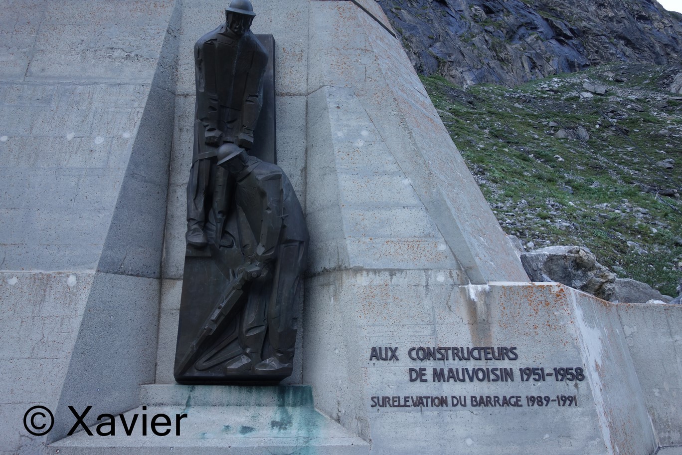
I started in the Mauvoisin hotel area, up the paved road, cross the dam wall to the east side of the dam, at the end of 3 short tunnels I climb the first ladder, 4 meter high, the rail bends north and 5 minutes later another ladder is more imposing, about 10m high.
After this second ladder the trail bends south again and passes in a narrow section against the wall, it is equipped, zero difficulty.
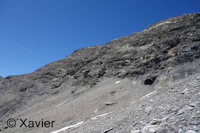
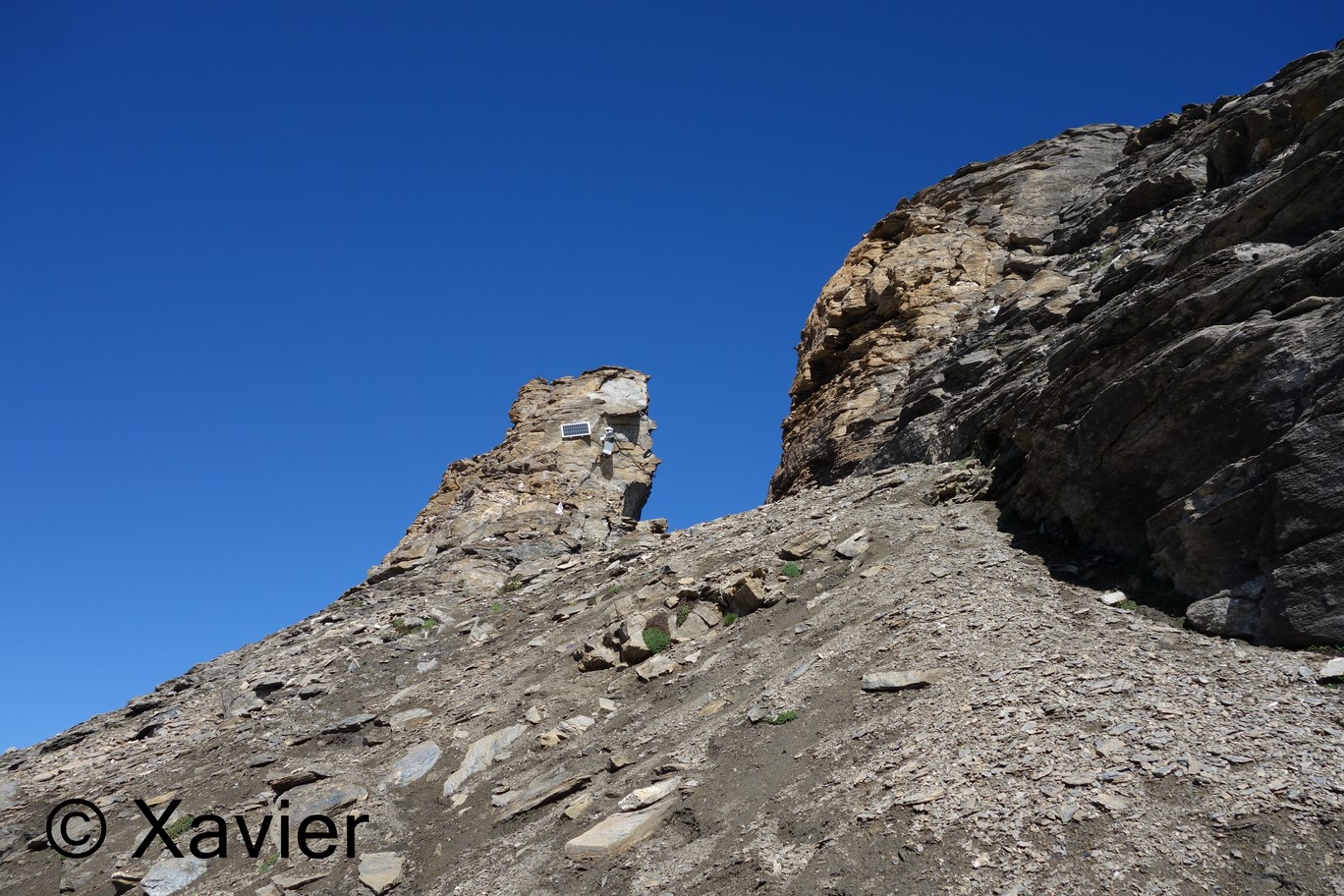
It follows a steep climb in a green environment, where you can see many edelweiss, the trail quickly gains 400m of height difference in successive zigzags, at 2350m i approach a huge rocky bar, which is bypassed on the left.
Continuing around the rock bar on the left side I come to the first chain-equipped part, it is very well equipped, it is an exposed section.
After this part another section with chains, much less exposed than the first, at the end of this section i come across a suspended ladder, which is easily avoided by going to the right or left, here, i am around 2600m, the trail continues NE by the moraine of the glacier until very close to a small "flat" area, around 3000m.
From this local i point directly to the edge, full North, and i join the edge in the area of a huge gap at 3130m, on this climb to the edge very careful with any bouquetins, a huge group runned in a steep cliff and in front of me was a couple, i shouted and they had time to hide in a cliff, otherwise it could have gone wrong.
The rest of the course is always on the edge, there is never a definite trail but there are many cairns, the progression is never complicated, the conditions were also fantastic, the gravel was wet which allowed a good grip, all obstacles are avoided by passing on the right side, from time to time it's worth peeking at the amazing NO face of Le Pleureur.
Continuing along the edge i reach the point 3550m where the slope becomes seriously steep, curiously, the route does not become more difficult, it's just visually impressive.
A short flat section follows to reach the Le Pleureur Cross (3704m).
What a wonderful peak, from what i had read, honestly had an idea that it would be more difficult to ascend.
I reached the peak with a walk of 3h45m, stops included.
The scenery is awesome, Grand Combin, Mont Blanc massif, Dents du Midi, Weisshorn, Dent Blanche, Matterhorn, Dent d'Hérens, Mont Blanc de Cheillon, La Ruinette, are some of the visible peaks.
i stayed at the summit for over an hour, what a wonderful place.
With a full belly and after appreciated the scenery came the time to return, i descended to that part of the steepest edge and around 3600m you can see a trace that goes south, seemed very good but i was not sure that there was exit because there is a huge and wide rocky bar around 3250m.
Then I followed this trail south and lose altitude quickly, in 20 minutes lost 400m altitude.
Continuing down the south there is a passage around 3250m, near a big snow blanket, the view of the Giétro glacier is fantastic.
After this part I continue easily west towards the flat part around 3000m where i find the climb path, an extremely interesting variant to not have to go back down the edge, although uphill is not advisable due to the gravel moving at each step, in an hour of descent, had already lost 1000m of altitude, at a good pace but without running.
The rest of the descent was entirely along the same path, it is advisable to maintain concentration at high levels for the descent of the last part with the currents.
2h20m was the time it took me from peak to car, at a good pace.
i arrived at the car at 15h30m, very happy, what an amazing day, awesome summit in the beatiful Val de Bagnes.
It's so good to live in Valais!
 Le Pleureur and the SW ridge
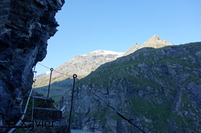
 Mauvoisin dam


 first ladder
 second ladder


 edelweiss
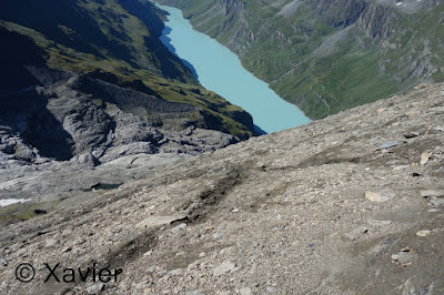
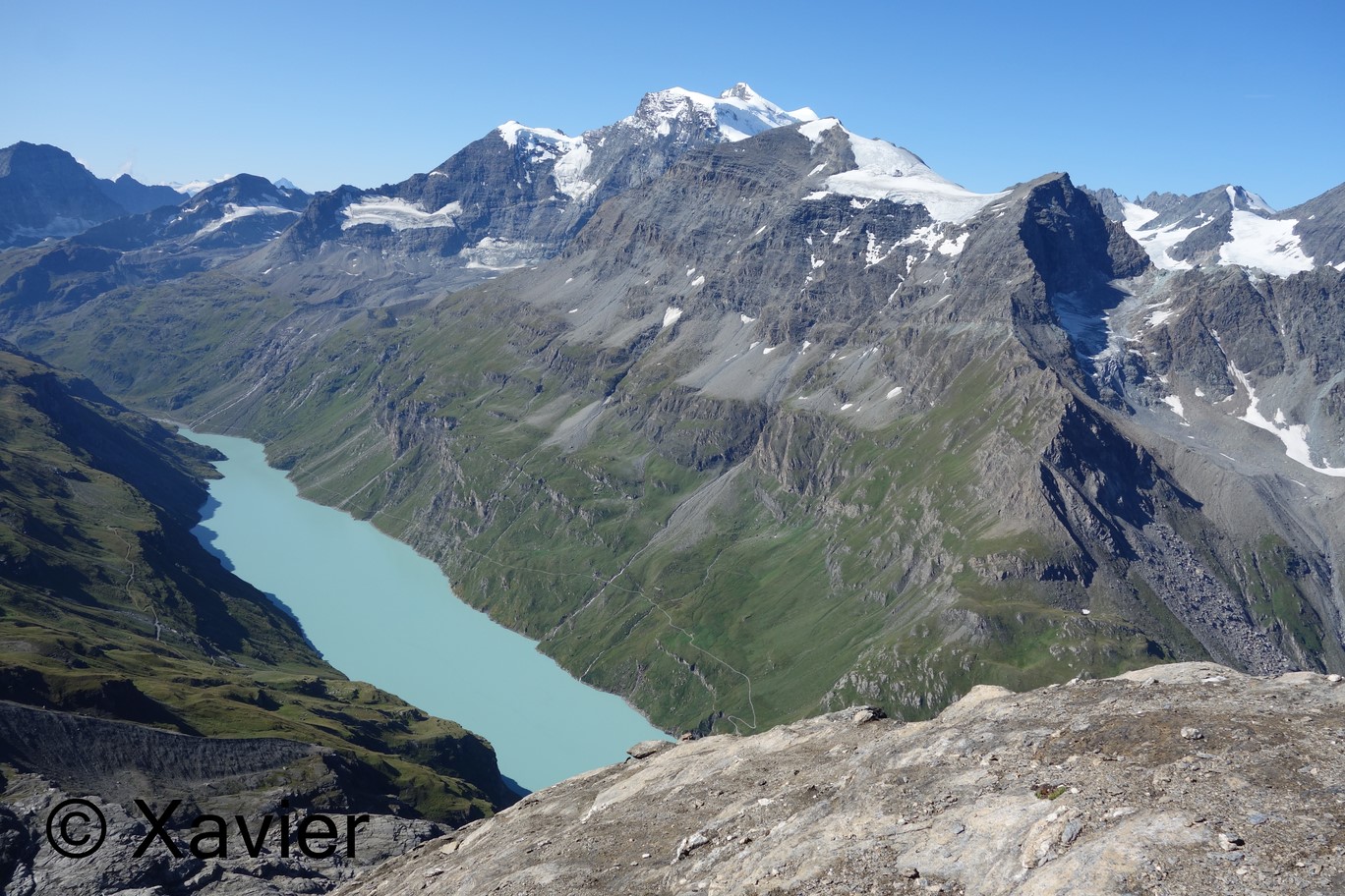
 lac de mauvoisin


 first chain section

 quite vertical


 second equipped section


 suspended ladder, avoid by passing on the left or right side


 glacier du giétro

 here i joined the ridge

 Mont Blanc de Cheilon and La Ruinette

 the breach


 Val de Bagnes


 group of the Combins


 looking back


 Grand Combin


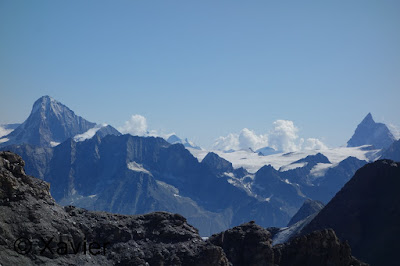 Dent Blanche and Matterhorn
 point 3550m, where the ridge becomes steeper


 the summit
 Mont Blanc de Cheilon, La Ruinette and glacier du Giétro

 Grand Combin and Mont Blanc
 Val de Bagnes


 East panorama

 Grand Combin
 Mont Blanc
 Tour Sallière and Dents du Midi

 Aiguilles Rouges d'Arolla
 Bishorn and Weisshorn
 Dent Blanche
 Matterhorn and Dent d'Hérens
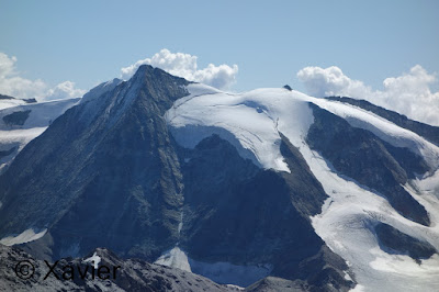 Mont Blanc du Cheilon
 Mont Gelé


 summit cross


 on the right side the "path" that goes south


 looking back


 looking back


Degree of difficulty- T5 I
track: here (the watch lost signal)
video do dia
Le Pleureur has been on my list for a few years, the day before this Sunday i had been in the Val de Bagnes and once again saw much of the way to this mythical peak.
After the rain of the day before, i counted with excellent conditions, sun and zero clouds, it was the perfect day to climb Le Pleureur.
I started in the Mauvoisin hotel area, up the paved road, cross the dam wall to the east side of the dam, at the end of 3 short tunnels I climb the first ladder, 4 meter high, the rail bends north and 5 minutes later another ladder is more imposing, about 10m high.
After this second ladder the trail bends south again and passes in a narrow section against the wall, it is equipped, zero difficulty.
It follows a steep climb in a green environment, where you can see many edelweiss, the trail quickly gains 400m of height difference in successive zigzags, at 2350m i approach a huge rocky bar, which is bypassed on the left.
Continuing around the rock bar on the left side I come to the first chain-equipped part, it is very well equipped, it is an exposed section.
After this part another section with chains, much less exposed than the first, at the end of this section i come across a suspended ladder, which is easily avoided by going to the right or left, here, i am around 2600m, the trail continues NE by the moraine of the glacier until very close to a small "flat" area, around 3000m.
From this local i point directly to the edge, full North, and i join the edge in the area of a huge gap at 3130m, on this climb to the edge very careful with any bouquetins, a huge group runned in a steep cliff and in front of me was a couple, i shouted and they had time to hide in a cliff, otherwise it could have gone wrong.
The rest of the course is always on the edge, there is never a definite trail but there are many cairns, the progression is never complicated, the conditions were also fantastic, the gravel was wet which allowed a good grip, all obstacles are avoided by passing on the right side, from time to time it's worth peeking at the amazing NO face of Le Pleureur.
Continuing along the edge i reach the point 3550m where the slope becomes seriously steep, curiously, the route does not become more difficult, it's just visually impressive.
A short flat section follows to reach the Le Pleureur Cross (3704m).
What a wonderful peak, from what i had read, honestly had an idea that it would be more difficult to ascend.
I reached the peak with a walk of 3h45m, stops included.
The scenery is awesome, Grand Combin, Mont Blanc massif, Dents du Midi, Weisshorn, Dent Blanche, Matterhorn, Dent d'Hérens, Mont Blanc de Cheillon, La Ruinette, are some of the visible peaks.
i stayed at the summit for over an hour, what a wonderful place.
With a full belly and after appreciated the scenery came the time to return, i descended to that part of the steepest edge and around 3600m you can see a trace that goes south, seemed very good but i was not sure that there was exit because there is a huge and wide rocky bar around 3250m.
Then I followed this trail south and lose altitude quickly, in 20 minutes lost 400m altitude.
Continuing down the south there is a passage around 3250m, near a big snow blanket, the view of the Giétro glacier is fantastic.
After this part I continue easily west towards the flat part around 3000m where i find the climb path, an extremely interesting variant to not have to go back down the edge, although uphill is not advisable due to the gravel moving at each step, in an hour of descent, had already lost 1000m of altitude, at a good pace but without running.
The rest of the descent was entirely along the same path, it is advisable to maintain concentration at high levels for the descent of the last part with the currents.
2h20m was the time it took me from peak to car, at a good pace.
i arrived at the car at 15h30m, very happy, what an amazing day, awesome summit in the beatiful Val de Bagnes.
It's so good to live in Valais!


Sem comentários:
Enviar um comentário