
text and photos: Xavier

 datasheet:
Distance - 18,85km


Distance - 18,85km
Height gain - 1431m
Height lost - 1431m
Altitude Max - 2771m
Altitude min - 1600m
Type - tour
Effective walk: 5h30m
Degree of difficulty- T4
track: here
video of the day
This Sunday i went hiking to Val Ferret, i parked the car at La Fouly.
Start by following the signposts to Le Basset(2771m), i go by the dirt road next to the lifts, at 2200m the hike starts to get interesting, i leave the lifts behind and follow the nice path on the ridge.
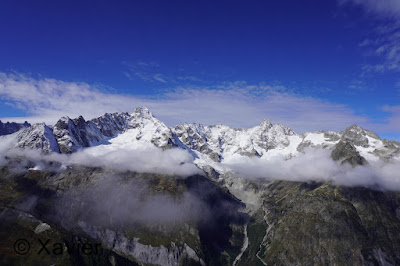
With 2h15m of hiking i reached Le Basset, what a nice view from this place, Combe de l’A, Grand Combin and Mont Blanc massif in the back, the path continues north a little before descending to Plan de Vouasse(2560m) where there are a couple of small lakes, after that the path turns South and heads to Col du Névé de la Rousse(2752m), there i stopped to eat my sandwich while observating the bouquetins at Mont Ferret.
After a pause of half hour i started going down by the path to Les Ars Dessus(1950m), a long and beatiful descent, once at Les Ars i follow north without joining the dirt road, i tried to stay at the same altitude until near Ferret where i continued north to catch the path that goes to Le Barfay(1814m), 15 minutes later i returned to the car parking at La Fouly, at a good moment, few minutes later started to rain.


 La Fouly
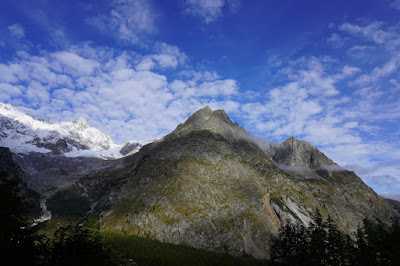


 Mont Dolent


 Grandes Jorasses


 Le Basset


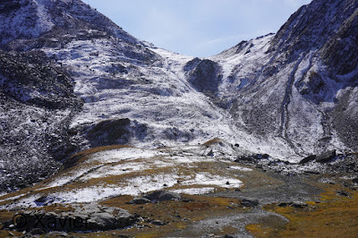
 Plan de Vouasse

 Grand Combin
 Mont Blanc massif
 Mont de la Fouly


 Grand Combin


 Col du Névé de la Rousse

 Col du Névé de la Rousse

 Mont Ferret


Degree of difficulty- T4
track: here
video of the day
This Sunday i went hiking to Val Ferret, i parked the car at La Fouly.
Start by following the signposts to Le Basset(2771m), i go by the dirt road next to the lifts, at 2200m the hike starts to get interesting, i leave the lifts behind and follow the nice path on the ridge.
With 2h15m of hiking i reached Le Basset, what a nice view from this place, Combe de l’A, Grand Combin and Mont Blanc massif in the back, the path continues north a little before descending to Plan de Vouasse(2560m) where there are a couple of small lakes, after that the path turns South and heads to Col du Névé de la Rousse(2752m), there i stopped to eat my sandwich while observating the bouquetins at Mont Ferret.
After a pause of half hour i started going down by the path to Les Ars Dessus(1950m), a long and beatiful descent, once at Les Ars i follow north without joining the dirt road, i tried to stay at the same altitude until near Ferret where i continued north to catch the path that goes to Le Barfay(1814m), 15 minutes later i returned to the car parking at La Fouly, at a good moment, few minutes later started to rain.


Sem comentários:
Enviar um comentário