
text and photos: Xavier

 datasheet:
Distance - 13,09km


Distance - 13,09km
Height gain - 1525m
Height lost - 1525m
Altitude Max - 3365m
Altitude min - 1826m
Effective walk: 3h40m
descent: 45 min
track: aqui
video of the day
To this saturday i planned to climb Mont de l’Etoile(3369m) starting in La Gouille at Val d’Hérens, it’s a weird Winter this year, it did not snow for 3/4 weeks!
From La Gouille i follow the summer route to Cabane des Aiguilles Rouges, it’s a long way, near the hut i went north directly to the join the SE face of the Mont de l’Etoile, it tooked me about 3h45m to gain the 1550m of height diference, the weather was nice but once at the summit it was very cold, about -13C , i ate something, took a few pictures, admired the landscape and then it was time to return.
I followed almost entirely the same route as in the way up, once again the snow was not outstanding but i finished with a banana face, nice day passed on the mountain.
 La Gouille


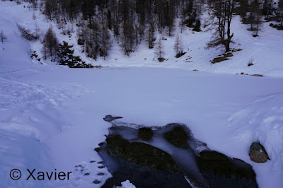 Lac Bleu


 Mont de l'Etoile


 Aiguilles Rouges d'Arolla


 Aiguilles Rouges d'Arolla
 Pointe de la Vouasson


 Mont de l'Etoile
 Bishorn and Weisshorn
 Dent Blanche
 Zinalrothorn, Grand Cornier and Dent Blanche


descent: 45 min
track: aqui
video of the day
To this saturday i planned to climb Mont de l’Etoile(3369m) starting in La Gouille at Val d’Hérens, it’s a weird Winter this year, it did not snow for 3/4 weeks!
From La Gouille i follow the summer route to Cabane des Aiguilles Rouges, it’s a long way, near the hut i went north directly to the join the SE face of the Mont de l’Etoile, it tooked me about 3h45m to gain the 1550m of height diference, the weather was nice but once at the summit it was very cold, about -13C , i ate something, took a few pictures, admired the landscape and then it was time to return.
I followed almost entirely the same route as in the way up, once again the snow was not outstanding but i finished with a banana face, nice day passed on the mountain.


Sem comentários:
Enviar um comentário